WASHINGTON, D.C. – D.C. braces for a powerful midweek snowstorm, with forecasts warning of a system that could bring heavy snow, strong winds, and travel disruptions.
Will D.C. See Heavy Snow? Here’s What We Know
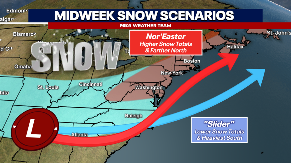
Meteorologists are tracking two possible outcomes for the storm:
1️⃣ A major nor’easter, which could dump over a foot of snow along the I-95 corridor.
2️⃣ A “slider” storm, which shifts the system farther east, leading to lighter snowfall in D.C.
🚨 Current models lean toward the second scenario, meaning a full-scale blizzard is unlikely. However, snow is still expected from Wednesday afternoon through Thursday morning.
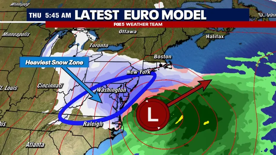
Projected Snowfall Totals for D.C.
As of now, forecasts suggest:
- ❄️ Up to 6 inches possible in the metro area
- ❄️ Heaviest snowfall likely south and east of D.C.
- ❄️ Uncertainty remains, as model shifts could increase totals
“We’re still 72 hours out from the storm, so final snowfall amounts may change,” experts warn.
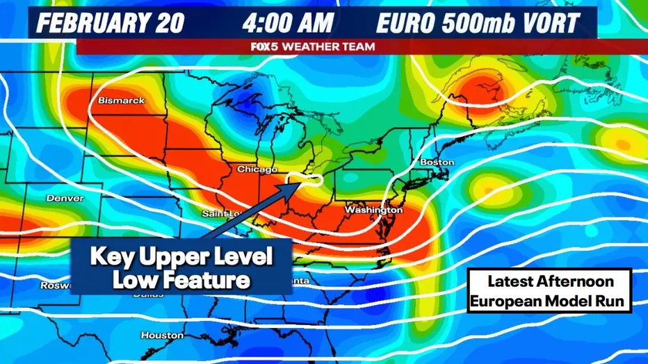
What’s Causing This Storm?
The storm’s intensity depends on a low-pressure system over the Great Lakes and Midwest:
- A strong system = Nor’easter with major snow for D.C.
- A weak system = Storm shifts east, less snow for D.C.
When Will the Snow Start?
📅 Expected snowfall window:
🔹 Wednesday Afternoon – Thursday Morning
Residents should prepare for travel disruptions and monitor updates as the storm nears.
How to Prepare for the Storm
✔ Limit travel on snowy roads.
✔ Stock up on essentials before conditions worsen.
✔ Stay updated with the latest forecast changes.
Final Thoughts: D.C. Braces for a Powerful Midweek Snowstorm
While D.C. braces for a powerful midweek snowstorm, uncertainty remains around how much snow will fall. A final track adjustment could increase totals, so stay tuned for real-time weather alerts.
🔴 Bookmark this page for updates as the storm develops.